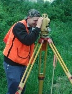
Our Services
"You'll never be sorry for doing it right!"
BOUNDARY SURVEYS: These surveys are for the purposes of establishing the boundaries of an existing parcel of land or for creating a new parcel from an existing one. A plat and new legal description of the property is then prepared for the transfer of the property if necessary.
MORTGAGE LOCATION SURVEYS: These are field inspections of a given property that are done to assist lending institutions and title companies in determining if there are potential problems with a property due to encroachments or insufficient deed descriptions. A drawing is prepared showing the location of improvements on the property. These are not boundary surveys and no monuments are set or confirmed to be correct. These should never be used for locating boundaries for construction purposes.
TOPOGRAPHIC SURVEYS: These surveys are typically done before a construction project for the purpose of preparing an accurate drawing showing the location of contours, surface features and underground utilities. A digital drawing is produced and it is then used by an engineer or architect to design improvements for a given site. On larger topographic surveys the area is often mapped from aerial photography with the surveyor adding details such as underground utilities.
GAS and OIL WELL LOCATIONS: These surveys are done for the development of new well locations. A plat is prepared for the application with the Ohio Department of Natural Resources.
FLOOD CERTIFICATIONS and LETTER OF MAP AMMENDMENT (LOMA): These surveys are done for the purpose of determining the location of buildings or a parcel of ground in relationship to Special Flood Hazard Areas as determined by the Federal Emergency Management Agency (FEMA). The surveys are typically done to assist a property owner in being released from a flood insurance obligation required by a lender. The final status of Special Flood Hazard Areas are determined only by FEMA.
CONSTRUCTION SURVEYS: These surveys are for the purpose of assisting a construction contractor in accurately placing improvements on a given site as designed.
AERIAL PHOTO CONTROL: These surveys are done for the purpose of setting targets on the ground and accurately measuring their location to assist a photogrammetrist in large mapping projects.
ALTA/ACSM SURVEYS: These are surveys that are performed to a set of standards that have been established by the American Land Title Association and the American Congress of Surveying and Mapping (ALTA/ACSM). These typically are done on a manufacturing or a commercial site and they include a full boundary survey of the property in addition to locating improvements, physical features, rights-of-way, easements and any number of issues that can affect the title of a property. In addition to the minimum standards, there is a table of optional elements that set the scope of the project in the ALTA/ASCM standards.